Home

Rotorua

Tongariro

Milford Sound

Southland

Queenstown
      Day1   Day2   Day3   Day4  

 Kepler Track 2008

Day 3 on the Kepler Track

NZ DOC

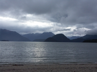
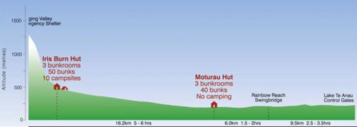
The third day on the Kepler Track should have been long but easy. It's a 10 mile hike, but down only a few hundred feet. It would have been long but easy except for the pounding rain the night before and on the several days before that. We found out later that Te Anau, the town nearest to the hike, had flooding in the center of town and the fire pump tracks were out all night.

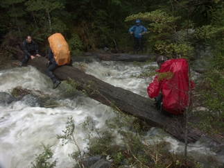
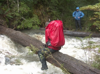
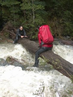
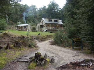
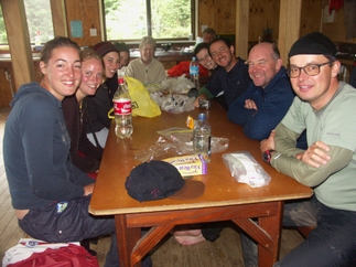
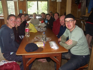
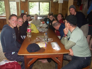
This flooding led to an interesting hike on the way down. A few miles into the hike we came to a over-burdened stream that had wiped out the bridge across it. Fortunately, there was a downed tree across the stream and we crossed on that, pictures below. Shortly after that, we came to a large windfall, where the trail was wiped out. The hard part was not crossing the shale that spread across the trail (if you've hiked in New England, you've done a lot more scrambling than that), it was crossing the mud that preceded the windfall. I sank into the mud up to my knee, and it was hard going get my leg out. In fact, I couldn't pull it straight out, I had to bend it and lift it out that way. Unfortunately, we don't have any other pictures from the trail. No one was in a mood for picture taking until we arrived at Motarua Hut.

(Click on any picture for a larger image.)

There were about a dozen of us who were hiking from the second to the third hut more or less together (a few people had left much earlier and a few left much later). We all stayed together while we crossed.

Bob anchored the side of the log where we all got on. Omer anchored the far end. And the Aussie who had taken our pictures the day before stood downstream to try to catch anyone who fell in.

It wasn't so much difficult as very awkward crossing the log, which was fairly wide. The trick was to lean forward and bend your knees back onto the side of the log and then push forward.
Omer was there to help everyone off the log. We ended up stepping into the water at the end of the log, and it was way higher than our boots. A few people tried valiantly to wring the water out of their socks, but it was barely worth the effort.

We were all relieved to make it to the hut. The hut warden told us that the couple who had left much earlier than we did had also crossed on the log. The warden in this hut called the warden in the previous hut, and had him take a look at the log crossing. He reported he would not have tried to cross it.

The warden did call for assistance with repairs, but it was Sunday evening and he had trouble raising the appropriate people, but eventually arranged for a crew to take a look the next day.

It's hard to see without enlarging the picture, but the sign in the lower righthand corner says, "Kiwi Zone". Unfortunately, they weren't out when we were there.

Here we are after having dried off. There's lots of food on the table since we hadn't eaten much on the trail and we'd worked pretty hard. We were all in high spirits at that point.
About half the people in the group continued the walk out shortly after these pictures were taken. It's only about 4 miles from this hut to the Rainbow Reach, where there's a bus pickup.
We'd plan the hike as a 4-day hike, and there wasn't much point in changing our plans and walking out, since we had a reservation at the hut and none in town, which was pretty well booked up.
There were four Israelis on the trip. Yaara and Tal (on the left) were traveling together, having just finished their degrees. Omer and Ayala were traveling together and the two groups had met on the trip.
A peaceful end to a tumultuous day.
...Back to day 2 On to day 4...