|
This was the view from the cabin at the
lodge where we stayed.
The day after we arrived at the lodge,
my luggage caught up with us. It had missed our flight in San
Francisco and finally been flown into Auckland. Air New Zealand
then flew the bag from there to a small regional airport in Taupo
and promptly drove the suitcase the 40 miles to the lodge. They
were really very good about the luggage, especially since the
problem was mishandling by United in San Francisco. |
|
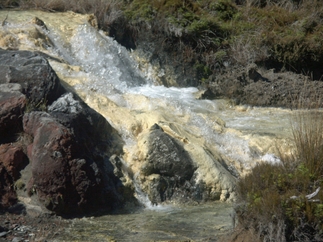
This was on a short hike before we did the crossing. These are
Silica Rapids: the white in the picture is silica deposits. The
water that comes out of the ground loses carbon dioxide and the
resulting pH change causes alumino-silicate deposits (guess which
one of us provided that explanation). |
|
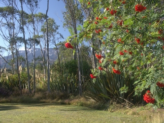
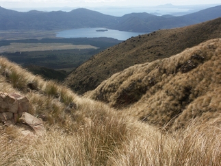
Even the easy hikes had great views. |

|
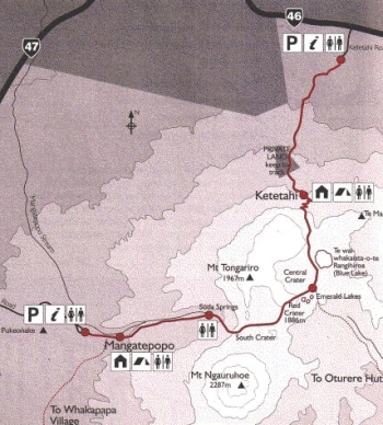
This was the sunset on the night before we
set off. The next morning, we had a pre-dawn start to the Tongariro
Crossing hike. Because it was a one-way walk and we finished
11 miles from where we started (about 30 miles by car), we needed
to get a ride at each end from a shuttle. The shuttles dropped
off around 6:30 a.m. and then picked up at 2:00 p.m. and 3:00
p.m. |
|
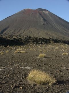
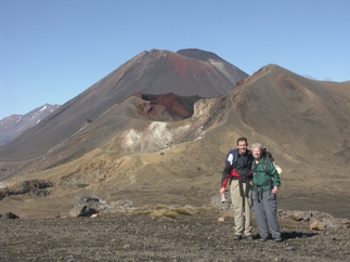
We've walked in a few miles on the flat.
This is a view of Mt. Ngauruhoe. We're about to start uphill
towards the Red Crater.
The landscape was very barren. |
|
We've now come up the Red Crater. This
is looking down the backside of the crater. The loose rock on
the trail made for an easy descent -- you could "ski"
down on the rocks, but provided a difficult ascent. It was kind
of like hiking up on ball bearings. Not very difficult, but quite
tiring.
On the right side of the picture, you can
see the steam rising from the side of the crater. |
|
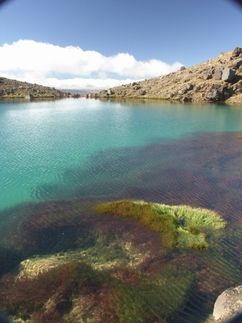
This is a shots of two volcanic lakes, looking
down from Red Crater. The lakes are brightly colored from minerals
in the soil. |
|
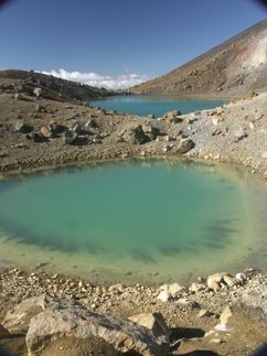
Emerald Lake. |
|
This is looking up back up the Red Crater.
You can see how steep the trail is. |
|
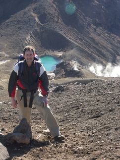
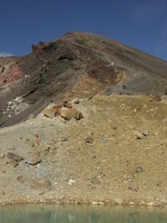
The Red Crater is in the middle of the picture,
and Mt. Ngauruhoe is in the background. |
|
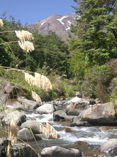
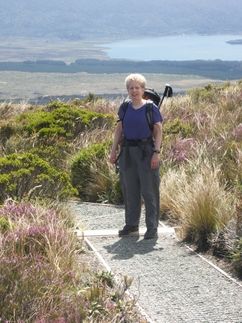
We've started the descent, coming down from
the Red Crater, eventually descending about 3,000 feet. Note
that the vegetation is much greener here. |
|
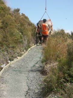
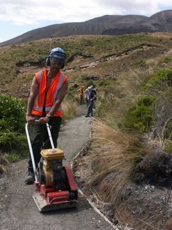
Not something you see on the trail every day.
The Department of Conservation (DOC) was doing some trail maintenance.
A helicopter would bring along a bucketload of paving material,
the crew would open the hopper and unload it. |
|
Once the bucket was unloaded, the helicopter
would take off for the next bucketful, and the crew would hurry
to compact it the material so they were ready for the next load.
There were about a half dozen people in the crew working on this |
|
And here's the result. It was a real luxury
having a paved trail, but I found it to be a hard hike down.
The trail would be flat for a few paces and then there would
be a step down, and then another flat section for a few strides,
and then another step. It was hard to get a rhythm going. |
|
The end! There were a lot of tired hikers
(me, for example) and some not so tired (Bob). Instead of "Where's
Waldo?" this is "Where's Harriet?" Bob knew better
than to ask me to stand up and pose at that point.
You probably have to enlarge the picture
to spot me. |
|
Back to Rotorua |
On to
the Milford Sound |