NZ DOC
|
|
|
|
|
|
|
|
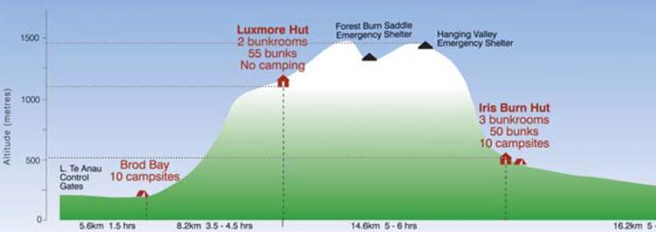
| Day1 Day2 Day3 Day4 | ||||||
|
|
|
|
|
|
|
|
| On the second day, the trail goes from Luxmore hut to Iris Burn hut, about 9 miles away. There's a about an Empire State Building and a half worth of up (roughly 1,700 feet) and then a steep drop in the last mile and a half. (Click on any picture for a larger image.) |
|
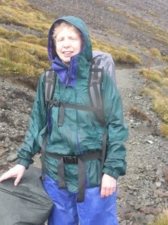
While it had stopped raining after dinner the night before, it started again overnight. This picture was taken shortly after we left the hut on the second day |
|
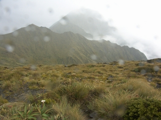
The rain is finally beginning to stop, and our moods are improving. The orange stake just visible on the right hand side of the picture (at about my shoulder level) is for trail spotting for hikers making the trip in the winter, when snow obscures the trail. |

|
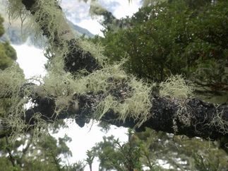
It was summer in New Zealand and there had been lots of rain in the last few days, so the flowers were out in profusion. |
|
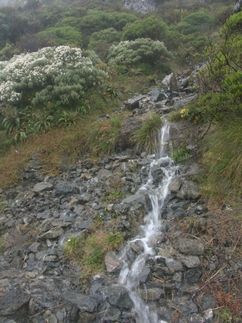
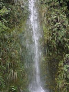
Wherever we went on the South Island, we saw lots of waterfalls. |

|
Now here's a room with a view! This first 7 or so miles of day 2 are well above treeline and are entirely out in the open, so facilities are a necessity. This is a bit off the trail, in back of a small shelter built primarily for winter use, in case of sudden blizzards. |
|
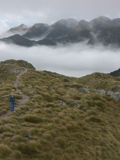
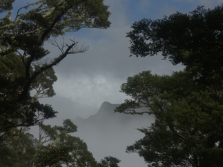
The day started to brighten. The undercast clouds provided some spectacular views. |
|
The views just kept getting better as we went along. |
|
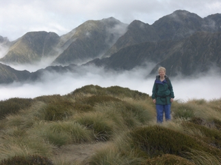
We hiked up a small promontory, joining some of the hikers who had left a bit ahead of us. This picture was taken by an Aussie who was hiking solo. Every time he would take a picture, Bob would review it and say try again. The Aussie was a very good sport about it, and we have a half dozen outtakes of this shot. |
|
Yet another spectacular view. By this point, I was pretty much convinced that the hike was a good idea, after all. |
|
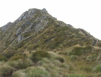
Although it's a bit hard to see in this picture, if you look closely, you'll find a series of steps all along the ridge starting almost at the very top of the mountain. (You can click on the picture for a larger view.) Bob took this picture after we had descended the stairs. Some people hiked the trail in the reverse direction, but I was glad we took the usual route. This would have been a tough uphill. This was first part of the steep descent. |
|
We're now further into the descent. As we lose altitude, the rain forest makes a reappearance. |
|
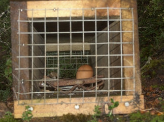
Stoats (a type of weasel) were introduced into New Zealand some years ago and they turned out to be a real predator of native species, including the kiwi, which is the national bird. This is a stoat trap. There are stoat traps every 200 meters on the back half of the trail. They've had some success, but stoats are still a major problem. |
|
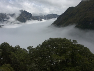
Another nice view as we descend towards the Iris Burn hut. |
|
One final waterfall before we reach the hut. We were very lucky this day. We got to
the hut about 4:00. About ten minutes later, the heavens opened
up and the rain poured down. Some of the
other hikers were not so lucky, and ended up soaked for a second
day in a row.
It rained steadily and hard from
4:10 until around 8:00 the next morning. The rain had just started
to let up when we started our hike the next day. |
| ...Back to day 1 | On to day 3... |